blah blah blah
Waterville Flume
Length: 6.6 miles out-and-backDifficulty (click for info): Moderate
Elevation Gain: 1137 feet (+240 feet on return)
Rating (click for info): 6/10
Height: 10'
Source: Flume Brook
Driving Directions:
Trailhead and parking area are West Branch Road in Waterville Valley, NH. From Exit 28 on Rt. 93, drive 10.2 miles northeast on Rt. 49 and turn left onto Tripoli Road (signs for Waterville Valley Ski Area). In 1.2 miles, bear right to avoid the ski area entrance and continue 0.6 miles down Tripoli Road. Turn right onto West Branch Road, cross a bridge, and immediately bear left into the parking area. Click here for a Google map.
About the Hike:
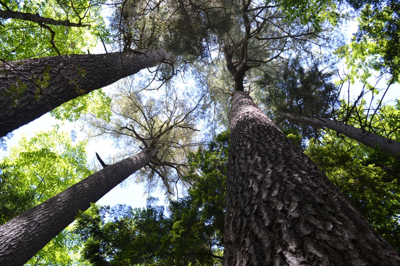
A flume is a natural formation where two high rock walls create a sharp notch in the terrain. The most famous of New Hampshire's flumes is the one in Franconia Notch owned by the state park system, which is home to Avalanche Falls. None other comes close to the sheer magnitude of the Flume Gorge, but this smaller flume in the Mad River Notch region is a worthwhile hike for a cloudy day. The gorge walls are quite impressive as you get up close to them. There are no singularly impressive waterfalls, but you'll enjoy some nice cascades flowing from the outwash of the gorge. On the way, you'll also pass the rocky outcrop on Scaur Peak's long west ridge known as The Scaur, providing fine views of Waterville Valley. The moderately long hike into the secluded valley where the Waterville Flume resides also takes in the scenery on the multi-use Livermore Trail, including brooks, wildflowers (in the spring), and the "Big Pines".
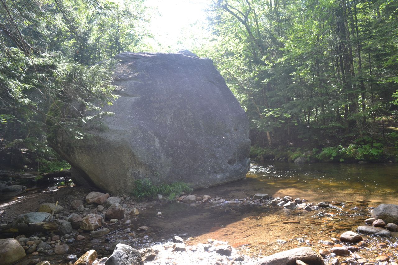
Start from the kiosk at the east end of the parking area and walk out to a junction. Turn left onto the flat, graded Livermore Trail, marked as Livermore Road on the cross-country ski trail signs. An easy walk of 0.3 miles leads out to a grassy clearing. Descend to pass another multi-use trail and cross a brook on a bridge, passing by Greeley Ponds Trail. In a short distance, the trail crosses Mad River on another bridge. Next, Boulder Path leaves on the right toward Snows Mountain and the trail soon passes an impressive boulder in Avalanche Brook, far below (walk a short distance down Boulder Path to get closer to it). Soon, Big Pines Path leaves on the left. This spur trail leads 0.2 miles down to a stand of pine trees near the Mad River. This side trip is included in the hike mileage.
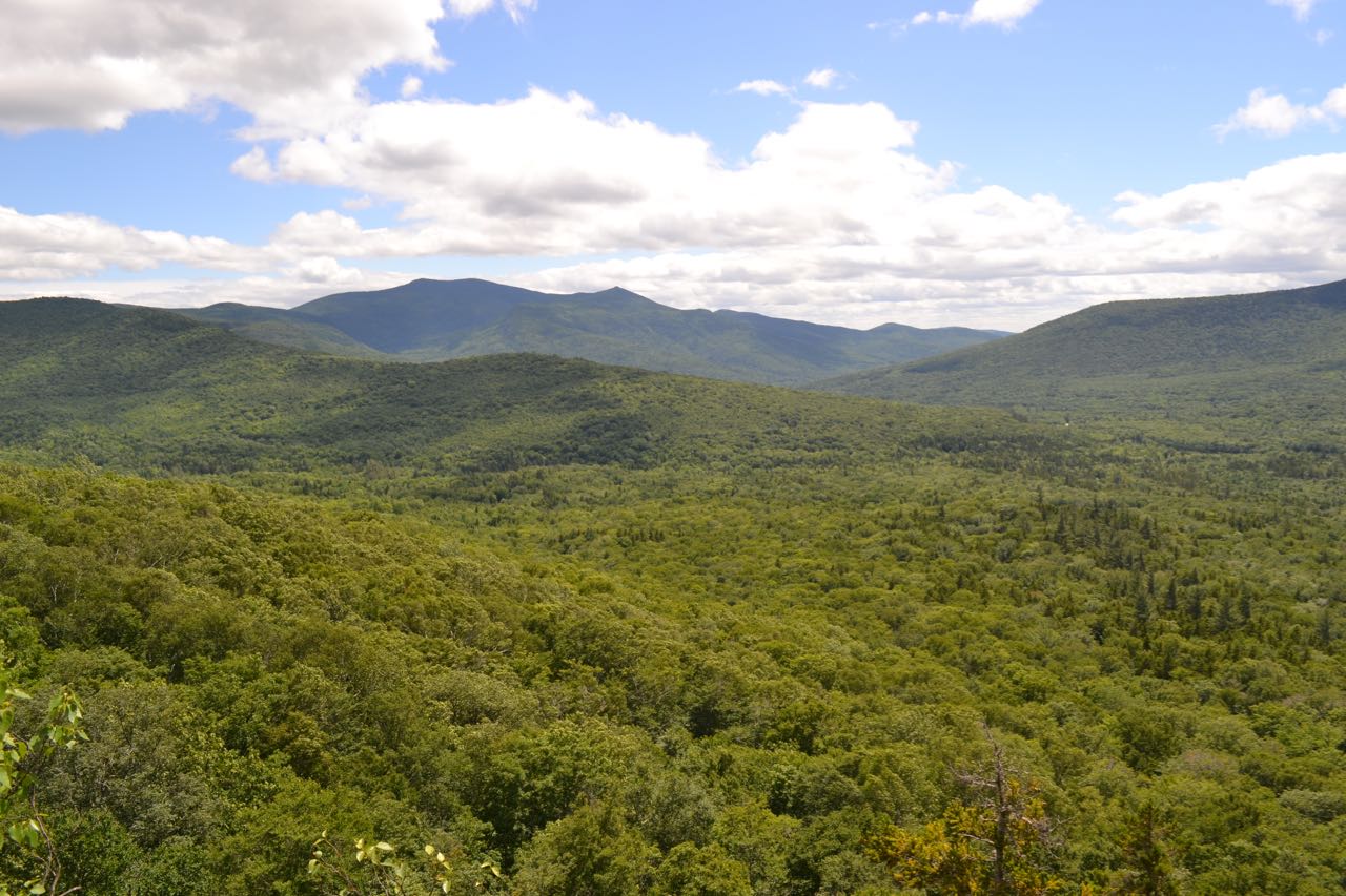
In 0.2 miles, turn left onto Irene's Path. This trail starts out level, then angles up a hillside, climbing easily for a while before flattening out again. In 0.9 miles from Livermore Trail, the trail takes a sharp right turn at a former trail junction, then climbs more steeply for 0.2 miles. It then makes its way around to a rock face behind The Scaur. The main trail continues along this rock face; to access The Scaur, turn right just before it onto a spur trail. Climb moderately, with one rock scramble, for a short distance out to the viewpoint ledge. Here, you will find a wide view over Waterville Valley to Sandwich Dome. To the far left, above the trees, are Middle and South Tripyramid. To the right and below is the long ridge of Snows Mountain, which blocks the view of the town. To the right of Sandwich Dome is Mt. Tecumseh and its ski area. By exploring the north side of the knob, you can find a viewpoint of Mt. Osceola and Thornton Gap, with the cliffs of East Osceola in full view.
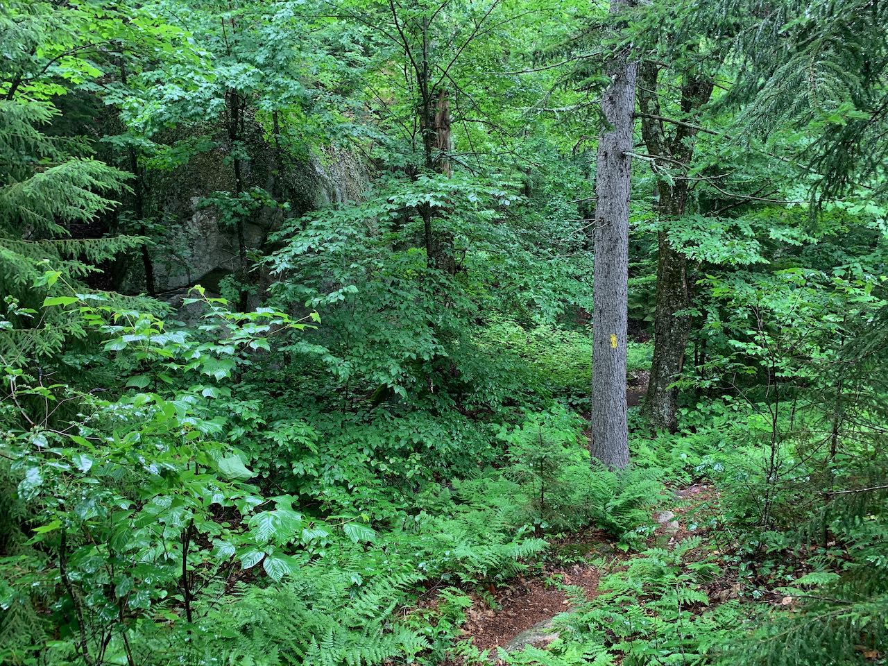
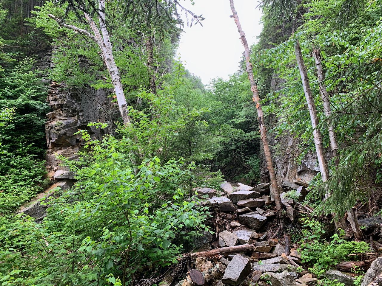
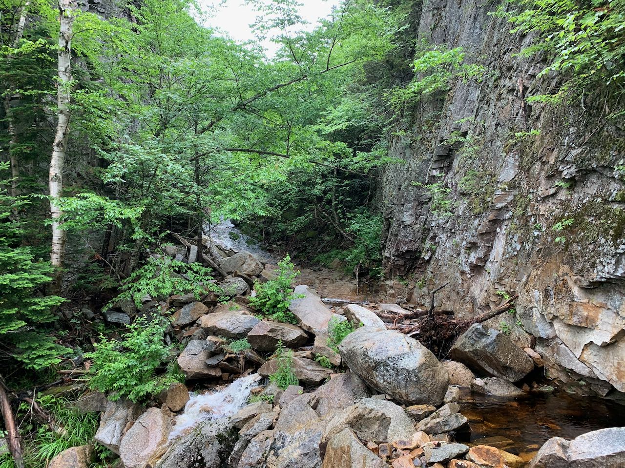
Backtrack to the base of the spur path up to the Scaur, and turn right to continue up the main trail, now called Irene's Path to commemorate the storm that destroyed the former trail which ran to the Waterville Flume. Follow the trail alongside the ledge face which bolsters the Scaur and up past a little knob with a break in the trees where you have another view over to the Waterville Valley ski trails. The trail dips down into a fern-populated glade and runs by an impressive boulder. Reaching the crest of the ridge which extends out to the Scaur from the main mass of Mt. Tripyramid, the trail runs across a flat area, then climbs uphill ever so slightly along the top, passing over and by patches of ledge. Around 0.6 miles from the Scaur, the trail begins to slide off the crest of the ridge and descend into the valley of the Flume Brook. The descent is gradual at first as the trail angles across the side of the ridge, continuing deeper into the valley, but it soon turns sharply downhill and descends on switchbacks with the aid of log and stone steps. In the middle of the descent, the trail passes an opening with a view through the trees toward the slopes of Mt. Osceola and Mad River Notch. After 0.2 miles, the descent eases and the trail resumes its trek into the valley, amongst moss-covered boulders. It slowly pulls away from the steep hillside and into some more open glades, and after another 0.2 miles, it reaches a trail junction with Old Skidder Trail. Take the left onto a spur trail that continues just under a tenth of a mile to emerge at the edge of the rock pile in the brook bed flowing out from the gorge. A few solitary birch snags stick out from the jumble. The size of the gorge walls immediately strike you as you explore the mystical area. The stream forms some small cascades as it bubbles out from the base of the formation. The best cascades are seen upstream through the gorge as the brook slides down a long ledge ramp.
Printable directions page